Information about the Terra device

Hi, I’ve been using the TwoNav app on my phone for a long time and have been very happy with it. As for a dedicated GPS device, I’ve always used Garmin, but lately, I haven't been satisfied with their products (lots of bugs). I’m interested in the TwoNav Terra, but I have a couple of questions:
1) The latest Garmin GPS units feature dual-band technology for reception. Am I right in thinking the Terra doesn't use this technology? Does it still provide an accurate signal, even in dense vegetation?
2) On my Garmin, I used a lot of national maps—converted to JNX or RMAP formats (OSM, IGM, regional maps, etc.). Can I add these custom maps I’ve created to the Terra? Is there a maximum file size? Is RMAP the only supported format?
Thanks
-
Thanks, Uwe. Of course, having a good raster map as a base (which I already have) plus a vector layer on top would be enough for me—but which vector map shows all the mountain and MTB trails? (Like the OpenMTB ones, for instance). Regarding the vector maps you linked to, do you mean these?
https://www.twonav-gps.de/sites/karten/hedgehog.html
I haven't looked into them in detail because I don't think Italy is included (I'm only interested in Northern Italy); or perhaps the "Alps" map might cover Northern Italy as well?
Addition:
Regarding those 'vmap' maps from the link above, the description says:
Alle OSM sind routable (Datenstand: 29.8.2026)
Besonderheit: Mit Hilfe von Papalunas Scripts erstellt. Schwerpunkte der Karte sind Bergwandern, Klettern & Radwandern. SAC Scale, MTB Scale, Wegbeschaffenheit u.v. mehr in die Wege eingetragen, Klettersteige mit Scale, viele POIs, z.B. Klettergärten, auch Notunterkünfte und Unterstellmöglichkeiten, Wegweiser, Fahrverbote für Fahrräder, Hausnummern, Öffnungszeiten etc.. Inklusive clay-file zu individuellen AnpassungThey seem to be maps similar to openMTB, apparently...
-

Yes I meant those maps. Try the Alps map, it covers Northern Italy. You can check the coverage at:
-
Thanks, Uwe; in the meantime, I had added a note to my previous message... These VMap maps look interesting—they might be just what I need, provided they cover my area (though I believe they do). I’m away for work right now, but as soon as I can, I’ll check and download them, and then update this thread. Thanks again.
-

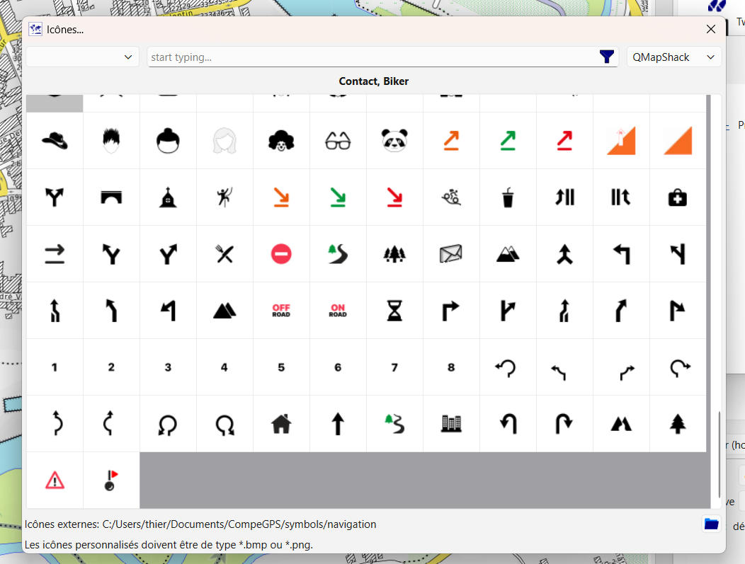
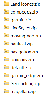
TwoNav Icon list in Qmap, used to make a road book for TwoNav GPS
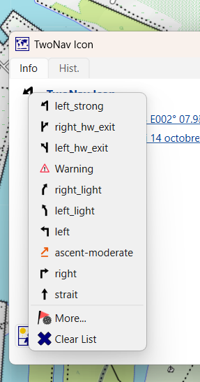
You have to add the library path as external Ico,s
Dream or reality?
- This morning, I update OSM (using the JOSM tool).
- This afternoon, I import the map in Garmin format—specifically the Freizeitkarte style (using the BBBike tool).
- Upon startup, I update the Qmap BRouter library.
The newly updated map opens on my screen (Qmap supports Garmin maps); I can plot a simple route or one with guidance instructions by adding icons from the TwoNav library (I simply need to specify the path to that library within Qmap).
So, I plot the route and add my guidance points or key waypoints.
I export the file to the TwoNav `/data` folder.
The next time I open Land, I mark the route to be sent to the GPS. It is then transferred to the GPS via GO Cloud, the Internet, and Wi-Fi.
When I turn on my GPS (while within range of a known Wi-Fi hotspot), the route loads automatically.Alternatively, I can manually retrieve it from GO Cloud directly on the GPS.
-
Thanks, Charles. I’ve been using Qmap for years to create GPX tracks for my old Garmin. I used to view Garmin maps in Qmap (the image shows Garmin’s famous—and useless—Trekmap). However, I never used icons; I’m not even sure if they existed for my Garmin. Where can I download them for the TwoNav? They look interesting; I assume that, besides being visible along the GPX track, they can also trigger an audible alert.
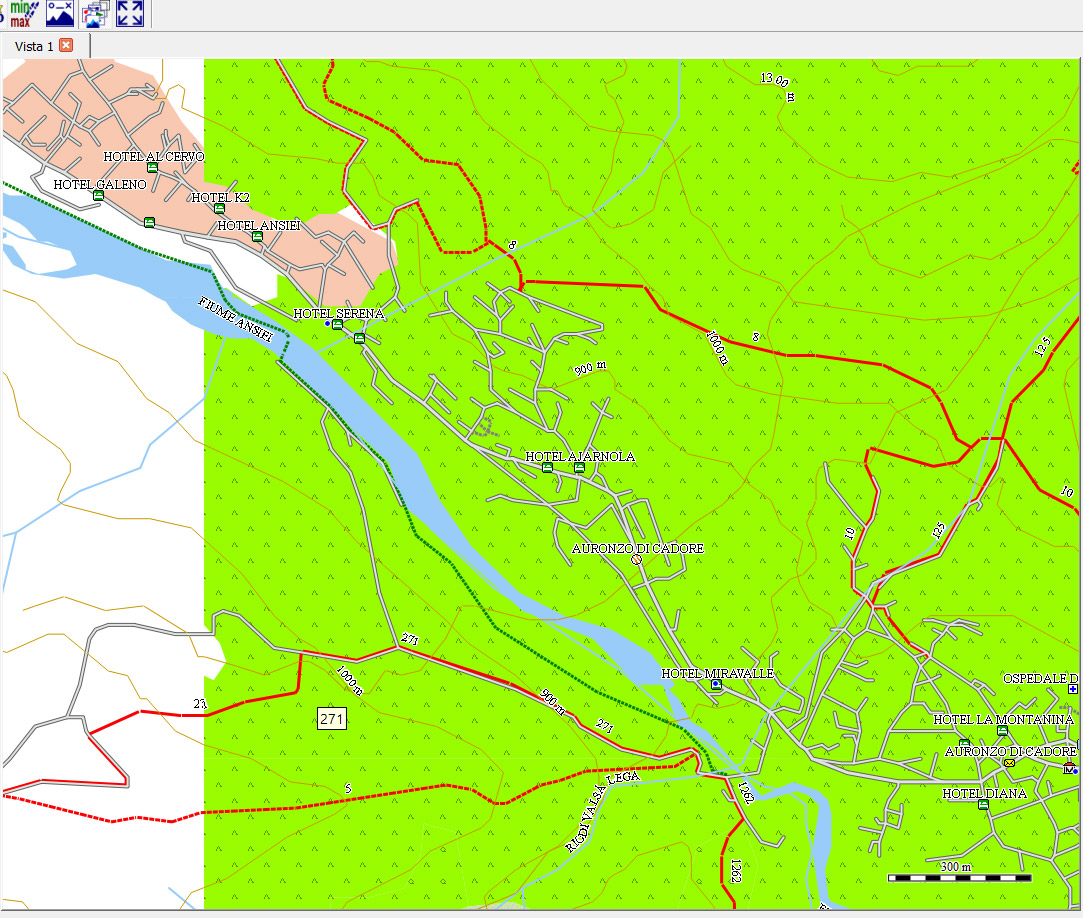
Second point: I already have various maps in .rmap format within Qmap. But on a TwoNav device (like the Terra), what is the maximum file size allowed for an .rmap or .vmap file? The ones I have (.rmap) are around 1.6 GB, but I could have created them for a larger area and in higher quality if the Terra supports larger file sizes.
-
Where can I download them for the TwoNav?
They look interesting; I assume that, besides being visible along the GPX track, they can also trigger an audible alert. YES You can set the radius circle around a WPT ou a Road book Point i used 20 m for the radius. Audio sound can be choice, which makes it possible to know the nature of the alert without looking at the screen.
unzipped Icon library is here C:\Users\thier\Documents\CompeGPS\Icons
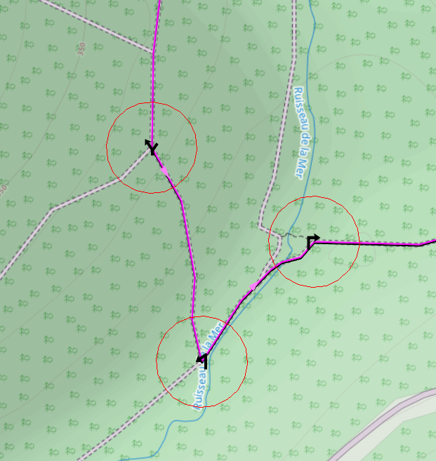
Icons and alert circle
But on a TwoNav device (like the Terra), what is the maximum file size allowed for an .rmap or .vmap file?
No limit

-
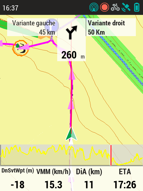
Road book on a Terra screen (Screen shot) OSM vectorial Map (*.vmap) Trendy IOF MTB display style
You can see the guidance icons and the alert circle (20m radius) before the turn. If the user strays 20m off-course (lateral deviation), an audible alarm sounds (I chose 3 beeps); 20m before the turn, an alert sounds to signal the upcoming turn (I chose the "Success" sound). So, while following the route, I pass the turn point; once past it, the next point remains visible on the screen (thanks to automatic scaling). A quick glance at the screen lets me memorize the direction of the next turn, so when the "Success" sound plays, I know which way to turn. If I get distracted, three quick beeps serve as a reminder the moment I deviate by 20m—alerting me before I’ve strayed too far.
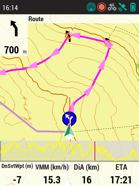
My longest route using this tracking mode was 10 hours without a single error; the GPS becomes a companion rather than just a tool.
The 20-meter accuracy figure accounts for the GPS itself, the maps, and the positioning of the track. You need to make sure to re-route imported GPX files, as they can sometimes deviate from the actual path. Qmap and Brouter handle this task well; the route shown in the image was generated using Qmap.
-
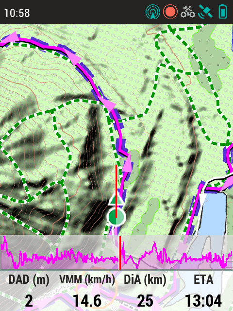
A raster map on a Terra screen—a screenshot taken to evaluate this type of map on this GPS.
The GPS screen resolution is just under 300 dpi, whereas the screenshot resolution is only 72 dpi.
There is a factor of 4 difference; the resolution on the GPS is four times higher, though it looks really good on the screen.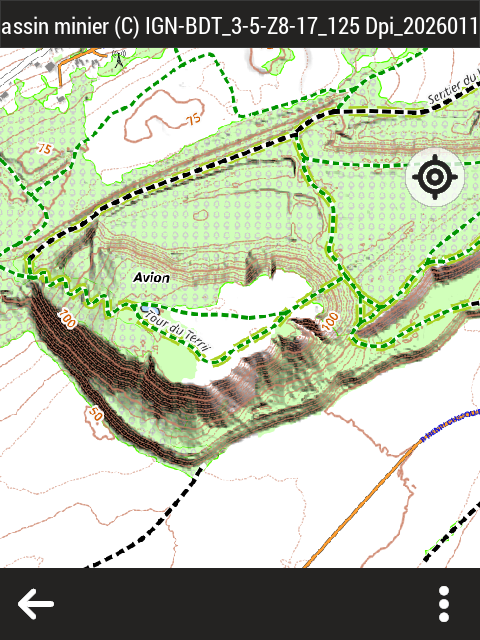
-
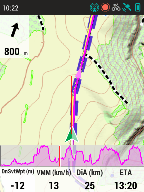
This screenshot was taken while following a route; it shows a raster map with a fixed scale (meaning the upcoming point could go off-screen). The goal of the test was to evaluate scale choices relative to screen size and the value of overlaying the route on the map in purple.
-
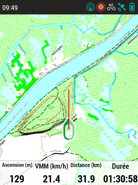
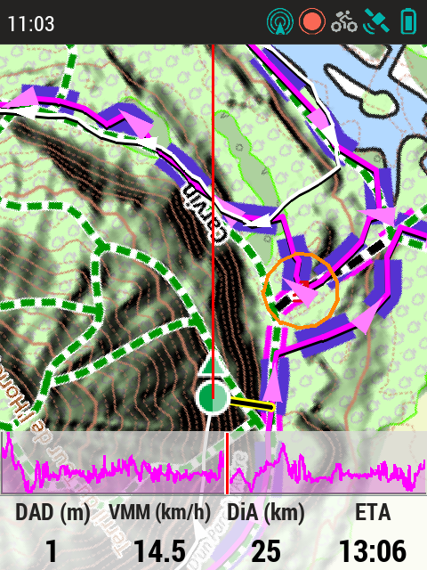
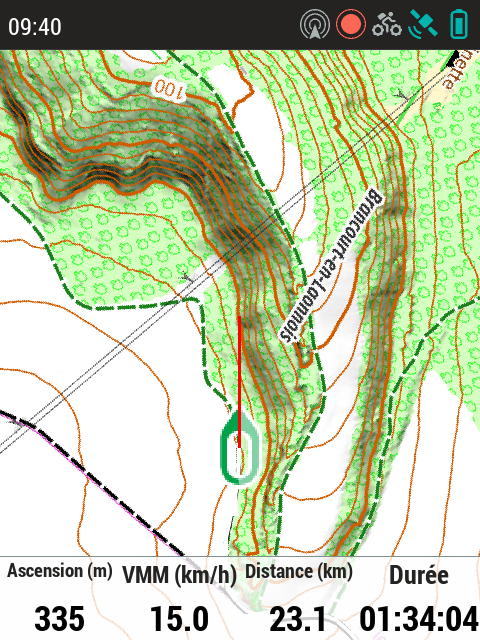
GPS usage (screenshot taken while on the route) without GPX tracking or turn-by-turn guidance—using map-view mode. The appearance of the paths is intended to indicate difficulty; in this illustration, the path lacks a difficulty attribute (green dashes on a white background). Screen shot 72 dpi real screen 300 dpi !
-
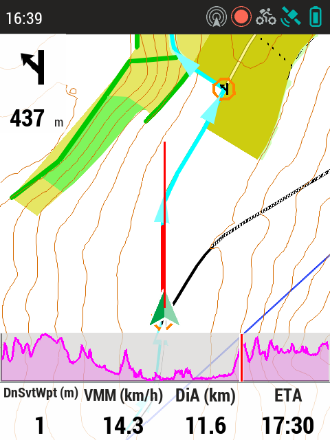
This case illustrates a potential route-following error: it is an area where, on one hand, there are significant discrepancies between reality and the map (a heavily trafficked area where paths shift quickly due to high foot traffic), and on the other, GPS positioning is difficult because you are at the foot of a tall slag heap under a dense canopy (meaning the view of the sky is very limited and GPS error increases). The GPS suggests looking for the path to the right. From memory, I am on the "new" path, but the next fork will be trickier since there are paths everywhere; the correct exit is indeed to the right. That said, the 20-meter alerts proved very useful that day, as they provide an immediate warning that extra vigilance is required.
Bitte melden Sie sich an, um einen Kommentar zu hinterlassen.
Kommentare
47 Kommentare