Performances enregistrement des traces.

Bonsoir,
Parmi les possesseurs de GPS:
- CROSS, CROSS Plus,
- TERRA,
- TRAIL 2, TRAIL 2 plus,
- Aventura, Aventura 2 plus,
Pourriez vous mettre ici un lien vers une de vos traces (lien de la page GO CLOUD) afin de faire un comparatif de la précision de localisation de ces GPS.
Merci d'avance
-
Freezing speeds and distances in the Land listing are TwoNav's calculation tricks which consider that you are stationary because the speed is too low. But speed like speed is itself the result of a calculation!
At the top Your Cross at the bottom the Garmin
Up and down Altitude, speed, slope.. Altitude, speed, slope.
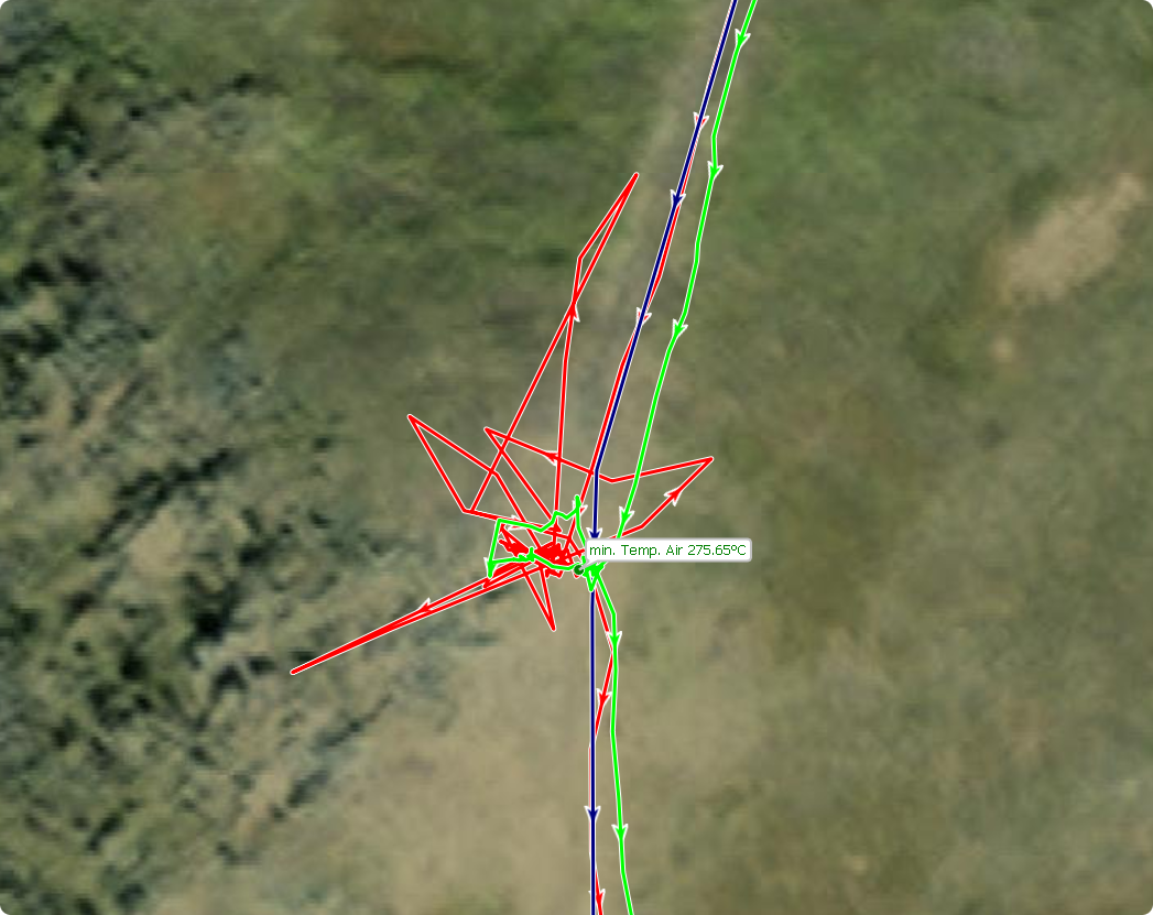
The desensitization can be seen on the speed parameter, because the GPS having calculated abherent positions, they are translated by crazy speeds...
We see 10 desensitizations on the CROSS (I considered V > 6km/h) and one "or two" on the 1030.
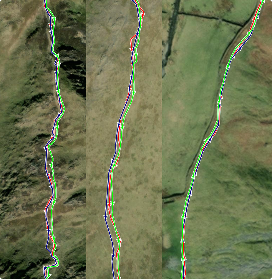
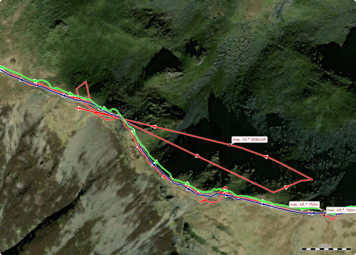
Bests Hikes
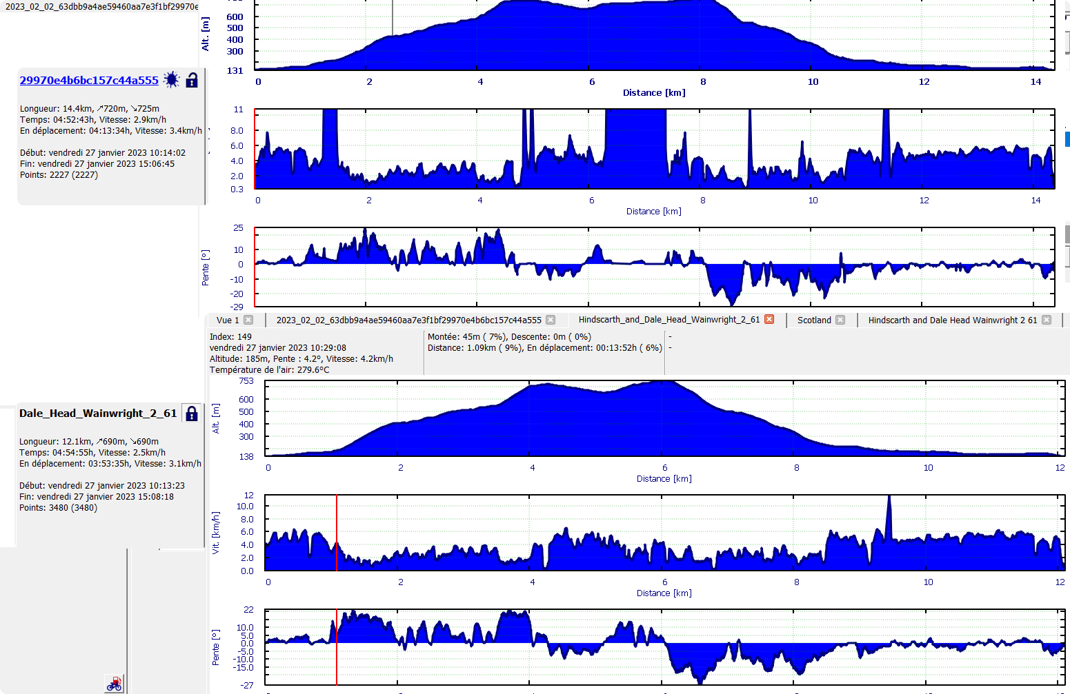
Distance :
Map track : 11,8 Km
Cross : 14,4 Km
Garmin 12,8 Km
-

David Butterfield:
I did run your Cross+ & Garmin Track through Trackcomp.
Thats the result:
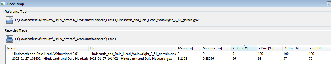
Using the Garmin track as reference (I know ideally we should use another reference device), as you can see, 66 points are deviating more than 30m, the rest seems acceptable. As I wrote before, with versions higher than 3.9 Twonav is not reliable following the predefined rules for tracklog recordings anymore, resulting in less reliable tracklog statistics for pedestrians. That and a probably broken weak gps signal filter including a missing working pause recognition (as Thierry pointed out) seems to be the reason for this mess for pedestrians. I have the feeling that pedestrians are not anymore in the customer range, Twonav is focussing. So I'm not very optimistic, that this will be fixed anytime soon.
-
Hello
And you have set the comparison threshold at 30 m, on this generation of chipset it should be less than 10 m.
In summary, on this track:
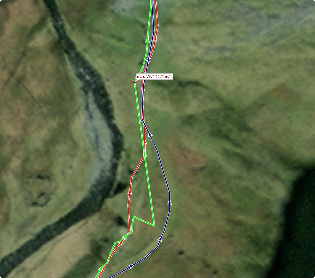
- When reception and accuracy are good the speed is forced to 0 and the distance frozen.
- During pauses or reception degradations, the speed is calculated and the distance integrated.
The reverse of what should be done. The distance from the CROSS has nothing to do with the route, it is a compilation of the noise, it is chance that it is close to the real distance.
Installed on a bike, mounted on the handlebar or in front of the stem, the location and the calculations will be correct, there will still be cases of untimely stalls.
There are two flaws:
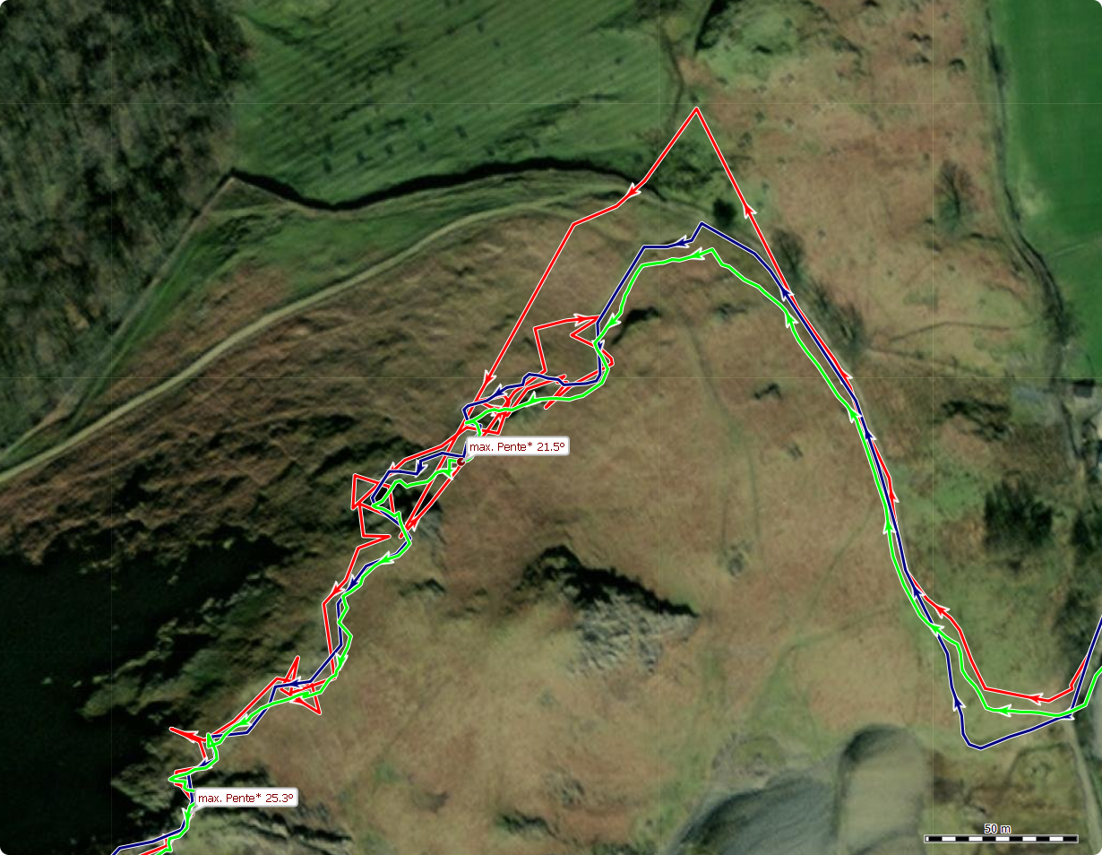
- The low speed filter integrated into the chipset is not implemented in the hiking configuration, and TwoNav tries to process it downstream, it's a bandage that shows its limits.
- The bug also seen on Terra and other Cross Plus, integration of the chipset, saturation at 12 of the satellites used for the FIX and untimely stalls. In principle it takes at least 4 satellites to obtain a FIX, three constellation ca makes 12 satellites, plus the SBAS so the minimum would be 13. Under these conditions it is not abnormal that in the event of loss of a satellite ca goes wrong, channels have to be reassigned, etc. The chipset data sheet, probably integrated into this generation of GPS, documents this case of forcing at 4, let's hope that TwoNav didn't do this stupidity.
Wearing your CROSS PLUS on the shoulder strap will improve the situation without correcting everything, you will have to wait for the corrections that TwoNav should make.
All GPS designers, including Garmin recommend via their respective after-sales service, to always keep a GPS in view of the sky, it must not be buried. This is due to the very principle of transmission and reception of a signal of an extremely low level that must be sought in the ambient electrical radio noise. A smart phone works differently it uses other sources to help its GPS.
Best Hikes..
-
And you have set the comparison threshold at 30 m, on this generation of chipset it should be less than 10 m.
No I didn't. Looking at the image I provided, 97% of the trackpoints are within a 10m distance to the Garmin trackpoints and 79% are even in a distance under 5m to the Garmin trackpoints.
To the rest you wrote I agree.
-

I tried the backpack holder. I couldn't get it to stay on my backpack strap where I wanted it to. It also made it difficult to remove the device to look at it.
It seemed to work quite well until I stopped to chat to some friends, when it lost the GPS and produced random points as usual. It then credited me with a speed of 29 km/h!
I have returned the Cross Plus for a refund. It appears to be a nice bit of hardware (apart from being needed to be kept the right way up) let down by poor software. Any GPS device has to handle the case where the signal is lost. I used to write software to program CNC machine tools and if I'd written software like this I would have lost my job. Ten days on from reporting the problem I have had no reply apart from the automatic acknowledgement.
-
Bonjour,
Lorsque les "conditions" de visibilité vers l'horizon sont sans aucun masque :
Un peut plus complexe car le GPS descend dans des Talwegs bien encaissés, mais le nombre de satellites utilisés pour faire un FIX reste élevé.
Le GPS est en avant de la Potence, l'antenne est donc parfaitement dégagée.
Cdlt
-

Bonjour Thierry ,
J’ai fait la sortie que vous m’aviez envoyée ( roadbook) voici le lien https://go.twonav.com/public/shared/2023-02-21-095359-frepillon-revisite-trk-13485368/ .
J’ai eu quelques décrochés ( 2 ou 3 )du GPS sur et tergiverser au départ vers Plessis-Bouchard puis j’ai quasiment suivi tout l’itinéraire .
Ma montre Garmin Fenix 5S indique 1100m de D+ contre +877m pour le CrossPlus qui est définitivement plus précis que la Garmin , merci Thierry pour ton aide et ton expertise qui m’a permis de mieux comprendre le fonctionnement des GPS.
bien à toi,
Manu
-
Bonjour "Emmanuel" ...
Merci d'avoir partager ta trace, je vois effectivement quelques décrochages, il y en as toujours mais l'amplitude est réduite cette foi, c'est mieux.
Coté altitude 2% d'écart entre ta trace enregistrée par le GPS et cette même trace recalée sur la BD Ortho IGN, c'est vraiment bien.
Pour que ca soit encore mieux, ce que tu peut faire c'est "nettoyer" ta trace au retour en ôtant les points d'arrêt de début et de fin. Cette action va oter tous les points avant que tu commence a rouler et ceux entre l'arrêt du VTT et l'arrêt du GPS. Comment : clic droit sur la trace /outil/oter les points d'arrêt...
Voila ce que ca donne cote altitudes:
- En vert la trace enregistrée par ton GPS sans les point d'arrêts de début et de fin
- En rouge la même trace après avoir remplacer les altitudes par celles de l'IGN afin de comparer les deux profils
Un écart entre les deux est tout a fait normal dans la gemme +/- 10%, la c'est vraiment "parfait"
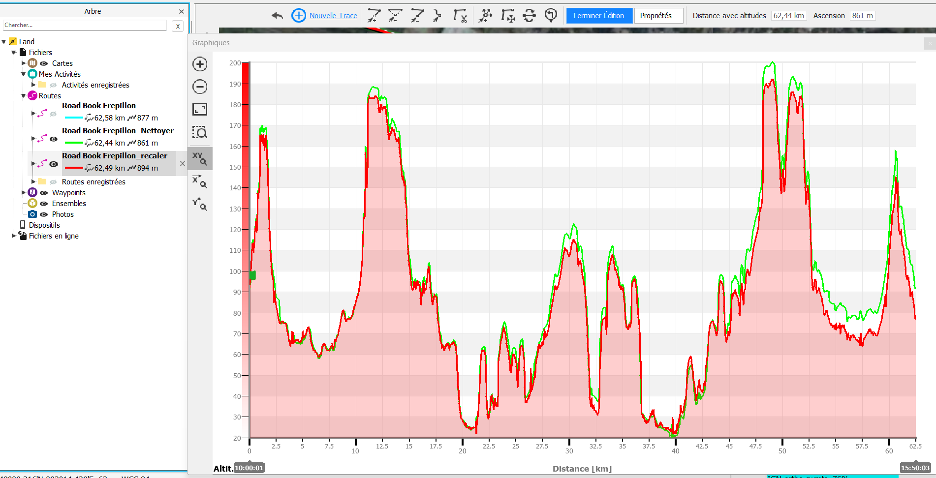
A titre d'exemple, ce WE dans mon cas il y a 30 % d'écart, mais le parcourt sur le terrain montre que les données IGN ne sont pas très précises, j'ai fait du relief "artificiel" créer par l'homme.
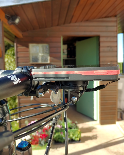
Le GPS CROSS et surtout le CROSS plus, doivent être installés sur le Vélo ou VTT bien devant le cintre... C'est impératif pour que ca se passe bien avec ce GPS.
Dans ce principe.
Comment trouve tu le suivi d'un Road Book a VTT ?
Bien cordialement
Tc
-
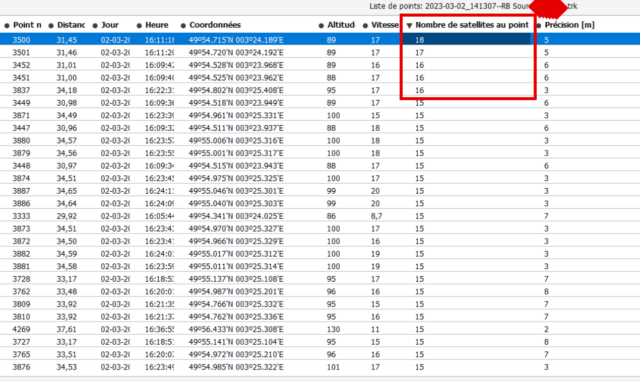
Pour "Emmanuel" ..
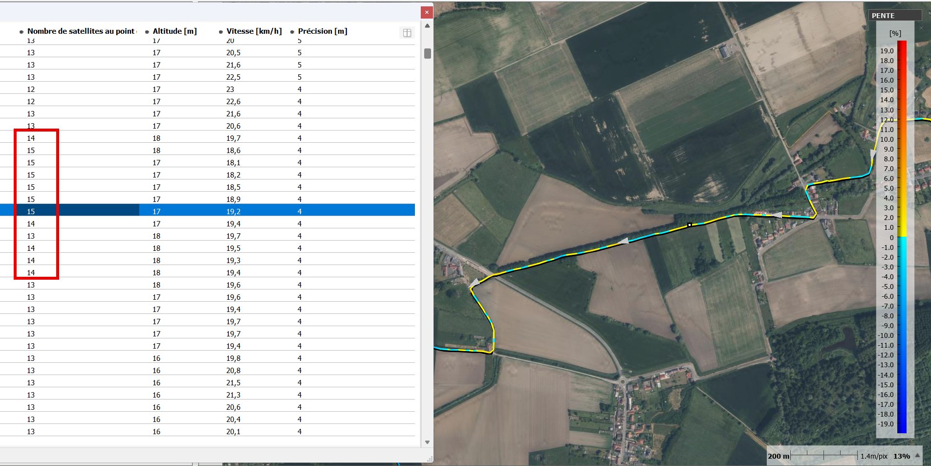
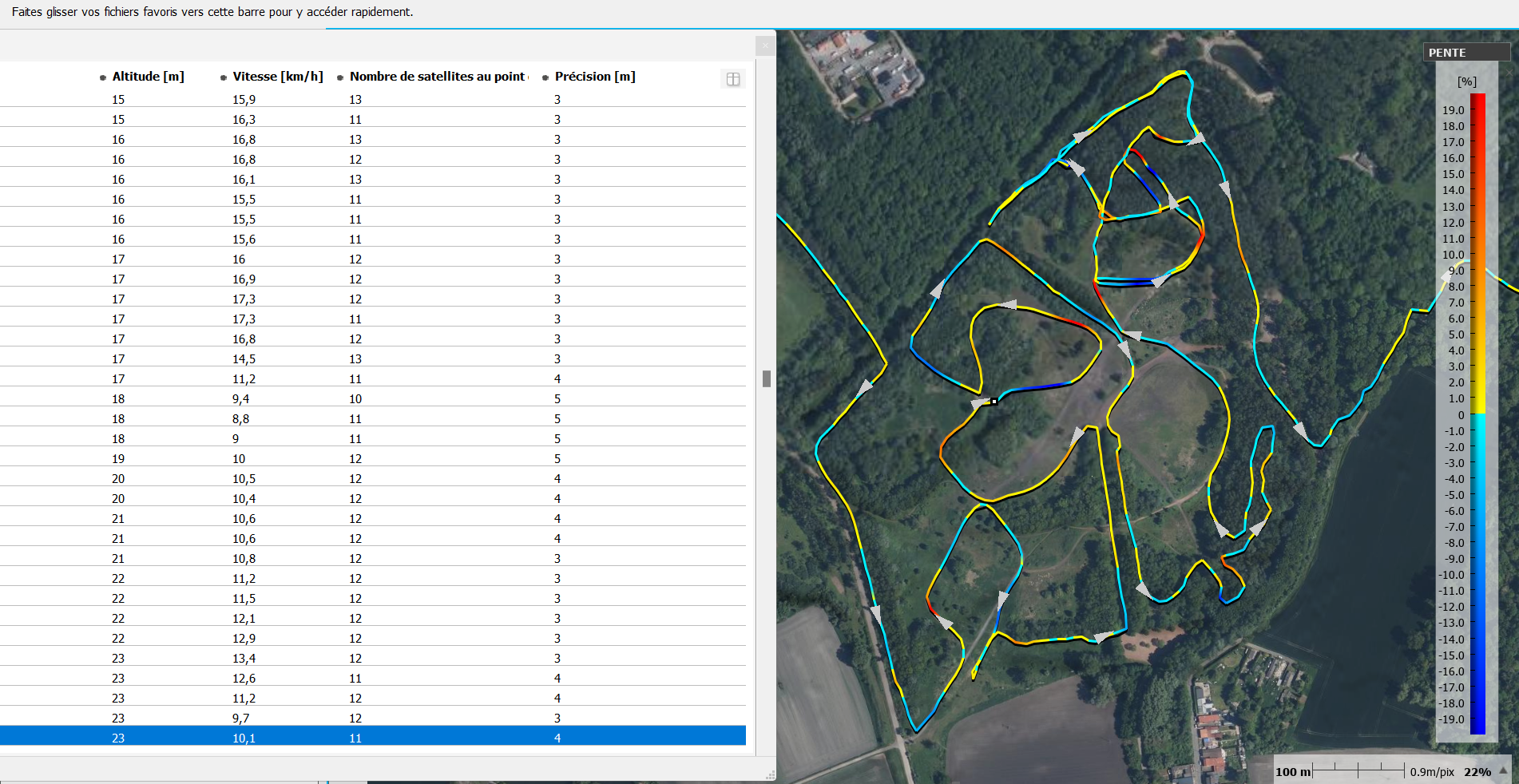
L'image ci dessous correspond à un point d'arrêt, la vitesse chute sous le seuil définit par la configuration, les points de FIX continuent d'êtres enregistrés, la vitesse est "forcée" à 0, les points enregistrés le sont avec le "bruit" de mesure du GPS. Dans ce cas c'est inférieur a 4 m.
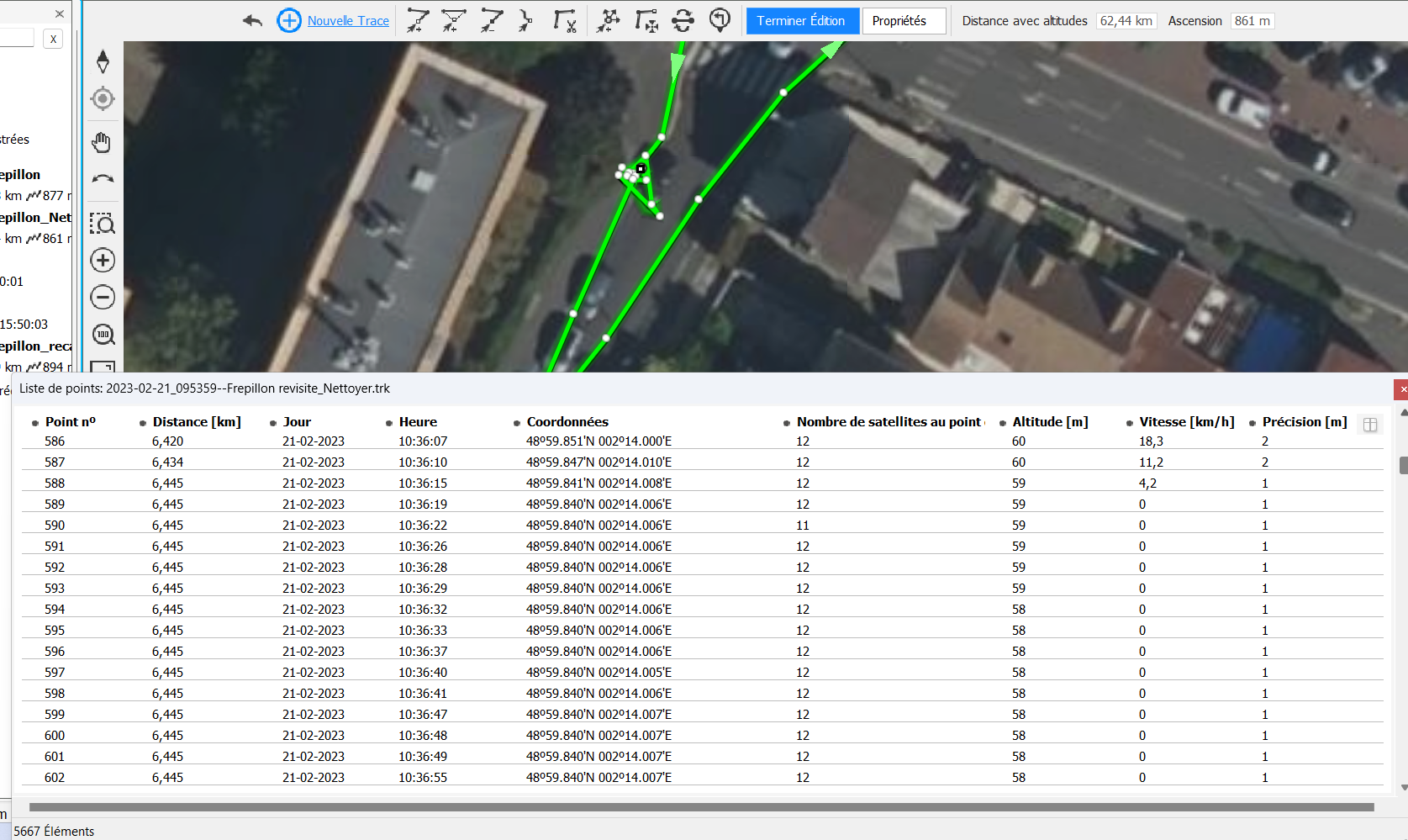
On voit bien que le GPS poursuit correctement ses "Fix" 12 satellites et une excellente précision. La mesure sur l'image montre que ca bouge de +/- 2 m max.
Ca c'est correct.
Cdlt
-
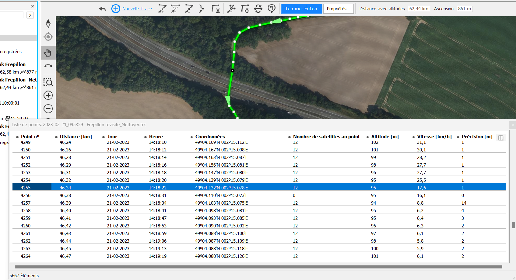
Suite,
Retour sur le cas du fameux passage sous le pont en forêt ou lors de ta précédente sortie, ça c'était mal passé.
La traversée (mesurée sur la photo) c'est environ 40m, soit de l'ordre de 5 seconde au maximum de perte de vue des satellites, à la vitesse enregistrée lors de l'arrivée à l'entrée du passage.
Constat :
- Le GPS, si on se fie au tracklog, perd les satellites et son FIX, et il lui faut 19 secondes pour rétablir un FIX correct (soit au moins 18 Fix) entre 14h18'22" a 14h18'41".
- Les coordonnées des FIX sont bonnes => Donc pas de décrochage
Il est "intéressant de noter" le "Pseudo Fix" de 18h18"31" qui est enregistré 9 secondes après le dernier Fix valide, ce qui correspond à la période "aveugle" ou tu as traverser le sous le PONT. Bien que le NB de satellites soit nul, la position est bonne. Donc le Chipset a fait correctement sont FIX.
Les Coordonnées des points sont bonnes, mais certaines data de l'enregistrement notamment le nombre de satellites fausses. => Ca sent bien le bug qq part..
-
Thierry,
J’ai apprécié le mode RoadBook , le cross BIP avant chaque changement de direction , c’est une fonction très utile, merci encore :) . Je suis très satisfait de mon achat , j’utilise Land9 sur mon MacBookPro de 2012 et c’est vrai que l’interface graphique de LAN est lente et se plante régulièrement .
bien sportivement,
Manu
Please sign in to leave a comment.
Comments
80 comments