Information about the Terra device

Hi, I’ve been using the TwoNav app on my phone for a long time and have been very happy with it. As for a dedicated GPS device, I’ve always used Garmin, but lately, I haven't been satisfied with their products (lots of bugs). I’m interested in the TwoNav Terra, but I have a couple of questions:
1) The latest Garmin GPS units feature dual-band technology for reception. Am I right in thinking the Terra doesn't use this technology? Does it still provide an accurate signal, even in dense vegetation?
2) On my Garmin, I used a lot of national maps—converted to JNX or RMAP formats (OSM, IGM, regional maps, etc.). Can I add these custom maps I’ve created to the Terra? Is there a maximum file size? Is RMAP the only supported format?
Thanks
-

Hello
For the first question:
La réception GPS multibande à pour objet d'éliminer la reception dite multitrajets, donc d'améliorer la précision de la localisation en ville (rues bordées d'immembles), en fond de vallée (ricochets du signal reçu sur les parroies rocheuses) et effectivement sous une canopée dense. Le terra n'est pas dité de cette technologie. Cela dit ça ne change pas la face du monde, il est possible que la trace puisse dans certains cas être décalée (la ou l'antenne recoit un signal réflechit), sinon Mr GNNS ne se serait pas casser la tête a inventer la reception multibande. Mais pour que ce soit efficace il faut aussi que les satellites aient cette capacité , or il me semble que c'est presque bon pour la constellation GPS, mais pas encore disponible pour Galliléo, pour les autres ce n'est pas à l'ordre du jour. Donc il faut un recepteur GNSS qui recoit les satellites GPS et que tous les satellites poursuivi par le recepteur soit pourvus eux aussi de la capacité multibande.
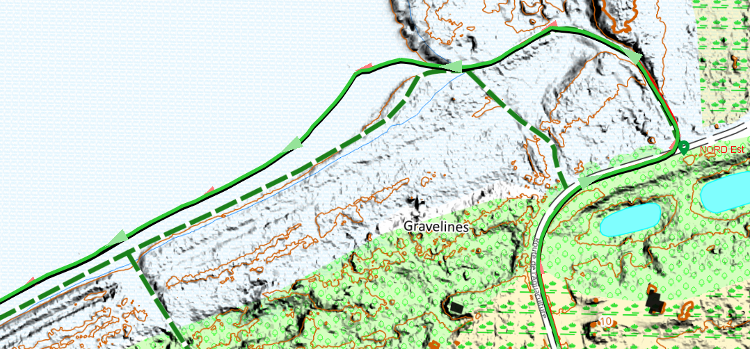
Clear skies near the sea; a multi-band trace and Terra overlap.
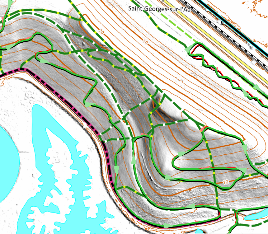
On a hill in the fog, the two tracks merge.
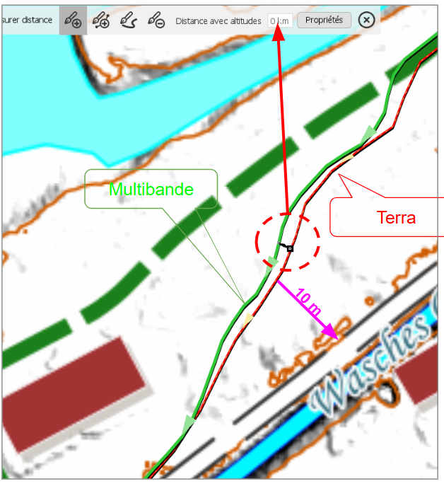
In the fog beneath a dense, low canopy. The 10 m reference indicates the magnitude of the error.
-
For the second question:
TwoNav's native formats are `.rmap` or `.rtmap` (and recently `.mbtiles`) for raster maps, and `.vmap` or `.mvp` for vector maps.
I use only open-source maps. For vector maps, I import data in `.osm` format, which Land then converts into `.vmap` (using a built-in tool) or `.mvp`. The source is the same as for Garmin (BBBike.de), but the export format is different (OSM). For raster maps, I use either MOBAC (exporting to `.rmap` or `.mbtiles`) or QGIS (open-source, exporting to `.mbtiles`).
You can also create maps from image formats (TIFF, JPEG, PNG), whether georeferenced or not (using the image calibration tool built into Land).
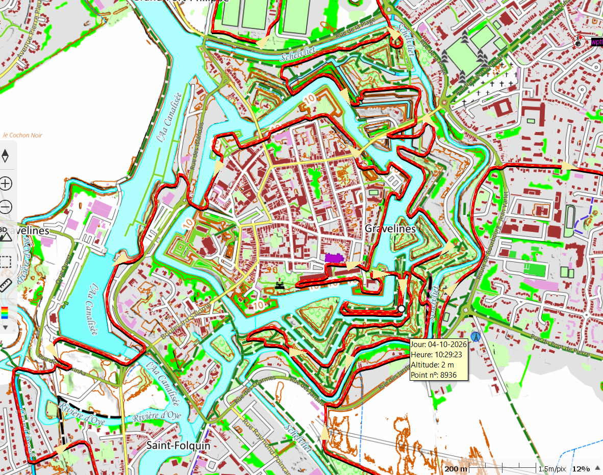
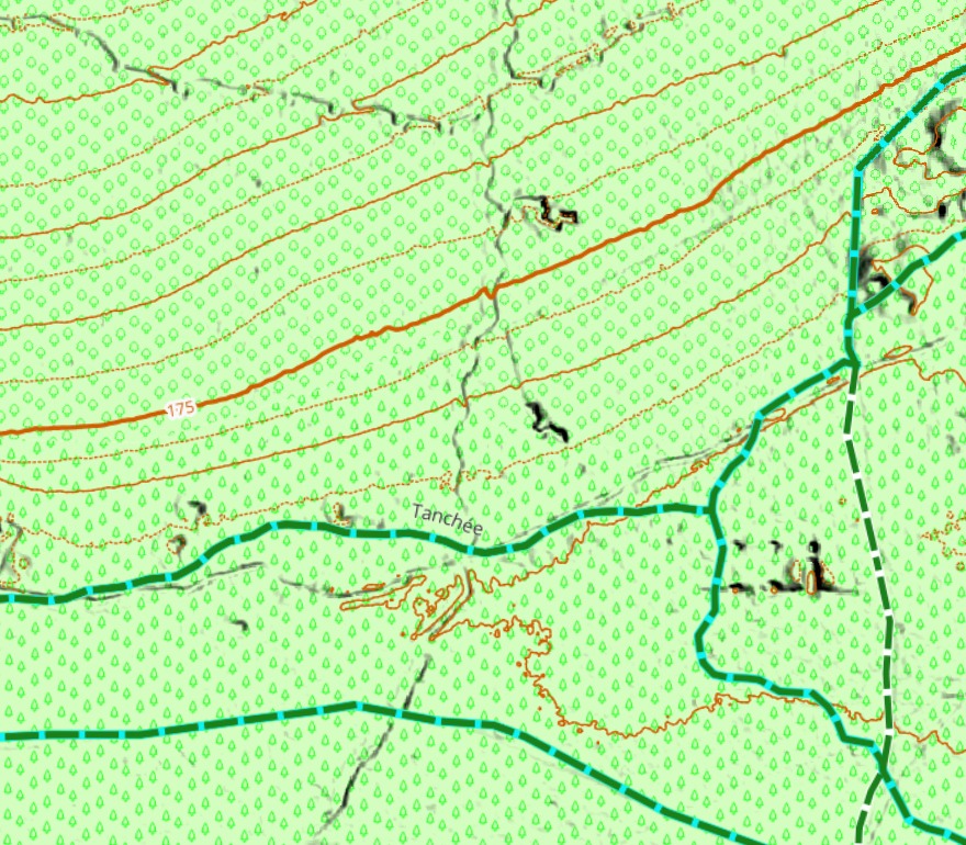
This is a custom raster map in MBTiles format (max zoom level 18); it is entirely open-source. Horizontal data comes from the National Geographic Institute (open source), vertical data is derived from the National Geographic Institute (0.5m LiDAR source), and roads, tracks, and trails were imported from OSM.
-
Thanks Thierry, very kind.
Looking at the maps on my old Garmin: I created some using Mobac and exported them in JNX format (though if I recall correctly, I could also export them as RMAP, so I imagine I could use those on the Terra as well). For other maps, however, I had to use Global Mapper—again exporting to JNX (and I don't remember if that program allowed exporting to a TwoNav-compatible format). Then, of course, I also have three maps in IMG format (OSM, Garmin Trek), but of those, the only ones I’d really want on the Terra are the OSM maps (specifically the ones I loaded myself), and if I’m not mistaken, that should be possible.
-
Hello,
One more thing—I almost forgot: Garmin devices have numerous size limitations, such as maximum numbers of waypoints, route points, maps, and so on. With TwoNav, you face no such limits; a single route file can include thousands of points. While Garmin integrates elevation data into routable maps, TwoNav uses independent files, which simplifies usage and allows for greater precision. The only real constraint is memory capacity—which has recently been increased to 64 GB, providing plenty of headroom. The Terra’s screen remains legible and bright, regardless of whether it is in direct sunlight or shade.
Best regards
-

Sorry to burst your bubble but you can't use Garmin vectormaps on the device. Vectormaps have to be created by yourself only in mpv or mpvf/vmap format (recent version of Land fail doing it in mpvf format which is more compact and ressorce friendly then mpv format - V896 was the last version which is doing this acceptable) or buy them from Compe (OSM database of some countries was recently fresh updated).
Creating maps in Land requires pro subscription, which is actually quite expensive compared to previous versions.
-
Thanks Charles for the input. I hadn't actually checked my 'ready-to-use' maps; I already had them all in .rmap format (I used to use them with the TwoNav app on my phone). The only ones not in that format are the 'img' maps (OSM, Garmin), but that shouldn't be a problem. I used an 8GB card with my Garmin and didn't have any issues (my maps take up a maximum of 6GB).
For Uwe, thanks for the clarification. I should mention upfront that I won't want to use Garmin vector maps on the Terra. However, I *will* want to use OSM vector maps. So, it won't be possible to have OSM maps on the Terra? (I used to load the well-known openMTB maps onto my Garmin.)
-
Hello,
OpenMTB Map is a map designed for Garmin devices; the data comes from OSM, and OpenMTB adds a specific rendering (visual style).
In principle, any user can do the same thing: import OSM data and apply a specific visual style. Sites like BBBike.de and Geofabrik.de offer this import capability. You can find all the information regarding OSM data imports on the BBBike website.
TwoNav includes an OSM map (e.g., *CountryName*26Q6OSM) with its GPS units; once loaded, this map has a standard (generic) visual style suitable for general use. In the properties section, you can customize the visual style to suit your needs—making it identical or very similar to OpenMTB, for instance. Personally, I use a visual style that closely resembles the IOF standard (MTB orienteering map).
You can apply this same style to your own OSM imports. As with Garmin, this involves a small associated file (*.clay); you create it by saving the properties of an optimized map, then simply duplicating it and giving it the same filename as the map itself.
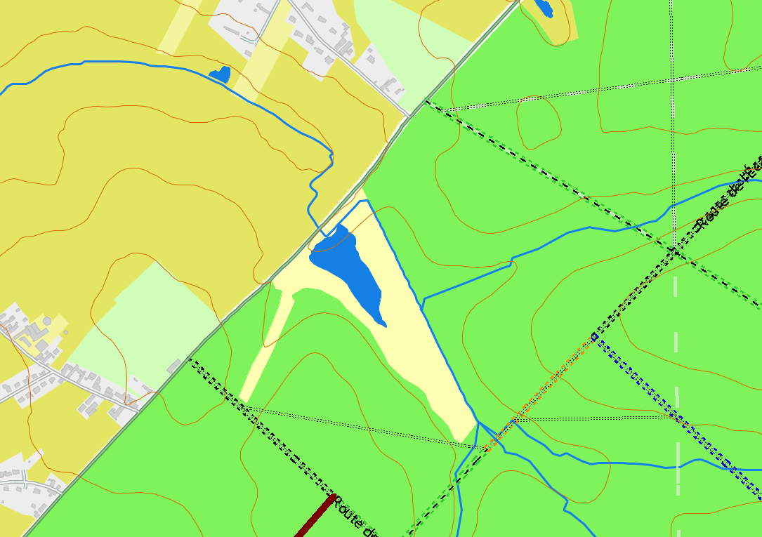
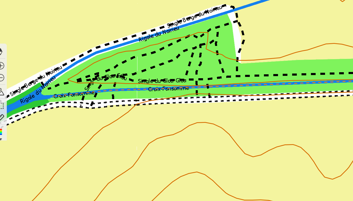
This is OSM Map with my personal customisation.
Yellow if the user see the Sky, Green under trees. For track and path the colors for the facility to ride (As defined by OSM data). I used two dotted lines, because a gpx track put au mask on the track or path draw on the map, with this issue the track loaded is located between the two lines, I can see le tracé GPX and highway classification facility to ride
You can also import OSM data into QGIS and export it as an MBTiles file using your own custom visual style.
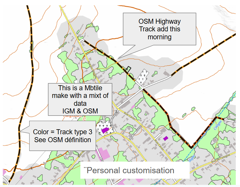
Here’s an example: this morning, while planning a future ride, I noticed two trails missing from the OSM map (the data wasn't there). I added these trails using the JOSM application (using aerial imagery and LiDAR terrain data as sources). By early afternoon, I had imported the OSM highway data to add as a layer to my map (simply replacing one layer), and my GPS map was up to date.
With open-source data, anything is possible now.
Exemple a raster Map from open source data, All data are defined in OSM (Open Mtb reda the OSM datas & add the visual look).
TwoNav GPS units do not feature automatic route calculation (something I call "Russian roulette," since you never know which way you'll end up going). Route calculation can be performed in Land, the TwoNav app, or on the GPS itself using the PaysOSM26Qx map before setting out on a hike. The "Fast Track" tool allows you to create a route with or without guidance.
-

"TwoNav GPS units do not feature automatic route calculation" > thats not true.
All the twonav devices that i have or have owned, beginning with Sportiva, are able to do a automatic route calculation for a point2point route. This can be done with every vmap, mpvf map which has the capability for it. If you can use fast-track, you can also use autorouting.
But don't expect to much from it. I mainly use it in unknown areas to find shortest way to a train or bus station.
Since first release of this functionallity more than 10 years ago, competeam doesn't developed it further. -
I have carefully analyzed the features of the Terra device, and I must say that the inability to easily use openMTB vector maps is a major drawback; if I were to deviate from my planned route (while mountain biking), I wouldn't be able to access information on alternative trails. For anyone who uses a GPS for mountain biking, this is a significant shortcoming. I am not familiar with the commercial agreements involved—given that openMTB maps seem ideal for Garmin devices—but if these vector maps were also compatible with TwoNav GPS units, the brand would likely be more popular.
-
Hello
Open MTB maps are based on OSM data—as are all maps of this type—meaning TwoNav's OSM maps are compiled using the same data. There is absolutely no reason why an alternative path visible on an Open MTB map would not appear on a TwoNav OSM map (the same logic applies to Suunto, HammerHead, and all other GPS or smartphone app providers, with the exception of COROS, which partly utilizes Google Maps). What differs between map providers (since Open MTB is not supplied by Garmin) is the visual style and the way paths are represented. Furthermore, regarding the scenario of straying from the planned route: the primary strategy is to avoid doing so by using the GPS's built-in route-following function. TwoNav’s implementation is excellent—superior to Garmin’s and more effective—making it the most efficient solution currently available (and the only one that handles intersections robustly, for instance). The second option, should you actually leave the planned route—whether intentionally or not—is either to return to that route (the ideal approach) or to choose an alternative (a riskier move). TwoNav indicates the direction needed to rejoin the planned route; getting back on track is easy—you simply need to read the map (a handy trick is to set up a quick alert). With Garmin, however, it’s more of a gamble: their GPS units feature an automatic routing function that doesn't rely on map data, but rather on Garmin's "hot routes"—paths most frequently taken by other Garmin users (hence the "Russian roulette" comparison, as you can't predict the route chosen). Experts often disable this function on Garmin devices to force the GPS to route based on the map data itself—though whether it makes you skirt a hillside or climb unnecessarily is another matter (perhaps AI will solve this in the future). Ultimately, whether using Garmin or another GPS provider—and regardless of the map—the challenge of rejoining a route after straying remains the same: you must rely on your map. If you are using a map based on OSM data (such as OpenMTB or TwoNav's OSM maps), the paths displayed on the screen will be identical, even if their visual representation differs. The key variable determining whether alternative paths appear is the map's currency—specifically, the date of the last update. In this regard, Garmin and TwoNav are on equal footing; you can simply import up-to-date OSM data into BBBike to generate a Garmin or TwoNav map (OpenMTB maps, for instance, should be refreshed weekly). You are accustomed to using OpenMTB—and that is certainly not a criticism; quite the opposite. The real point is that you would feel lost without this map.
OpenMTB is a map designed for Garmin GPS devices and the tools used to plan activities for Garmin units. It is not produced for TwoNav or any other competitor; while an online OpenMTB version could theoretically be converted into a TwoNav-compatible map, no such version exists.
Best hikes
-
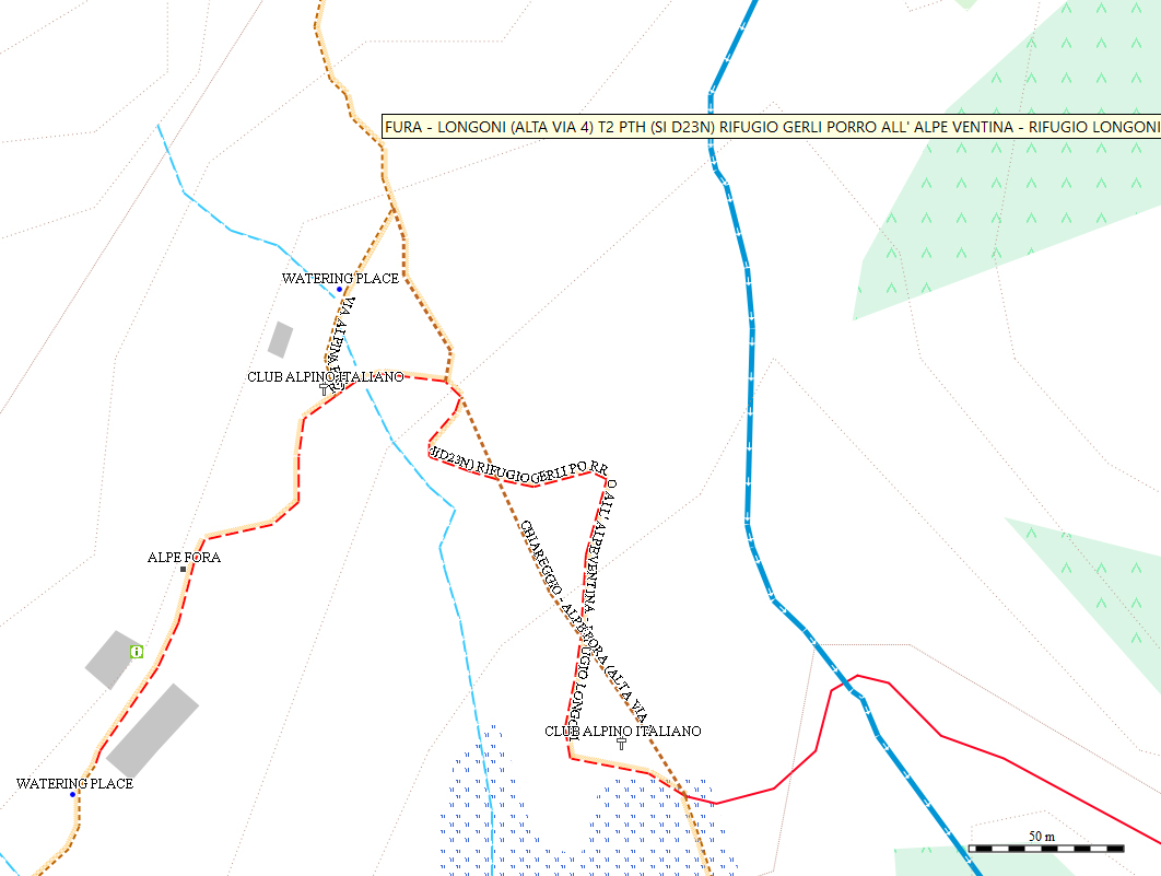
Of course, I can view the OSM map in TwoNav as well; however, the openMTB map (which is based on OSM) is a vector map. Beyond just showing trails, if I select a map object, it displays useful information that wouldn't be available on the standard OSM map. The photo shows the openMTB map (viewed here via QMap), and hovering over that trail reveals additional details. So, I’m wondering: is there a vector map in TwoNav format that offers OSM-style data with this kind of information? (for example, where does the OSM map in VMAP format above come from?)
Thanks
-
The TwoNav GPS package includes the "NomdeVotrePaysOSM26QX.vmap" map; this is a vector map published by TwoNav and derived from OSM data.
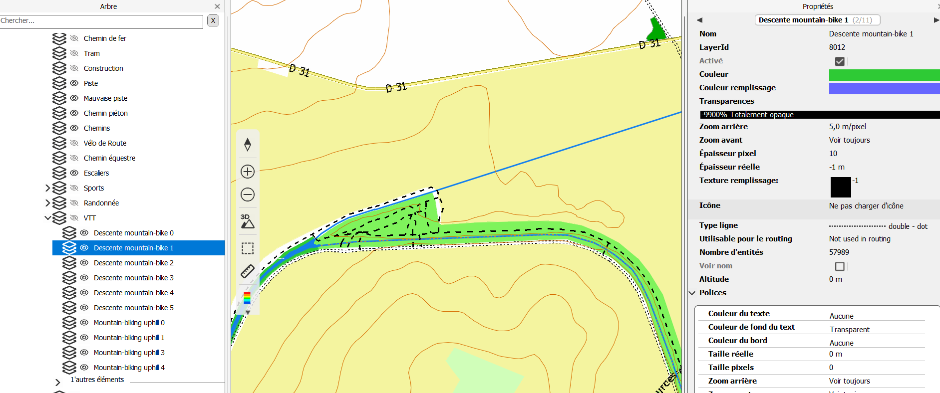
As you can see in this image, the data cannot be edited simply by hovering the mouse over it.
However, you can add more precise elevation data (on your current map, the contour lines are at 20m intervals and appear segmented).
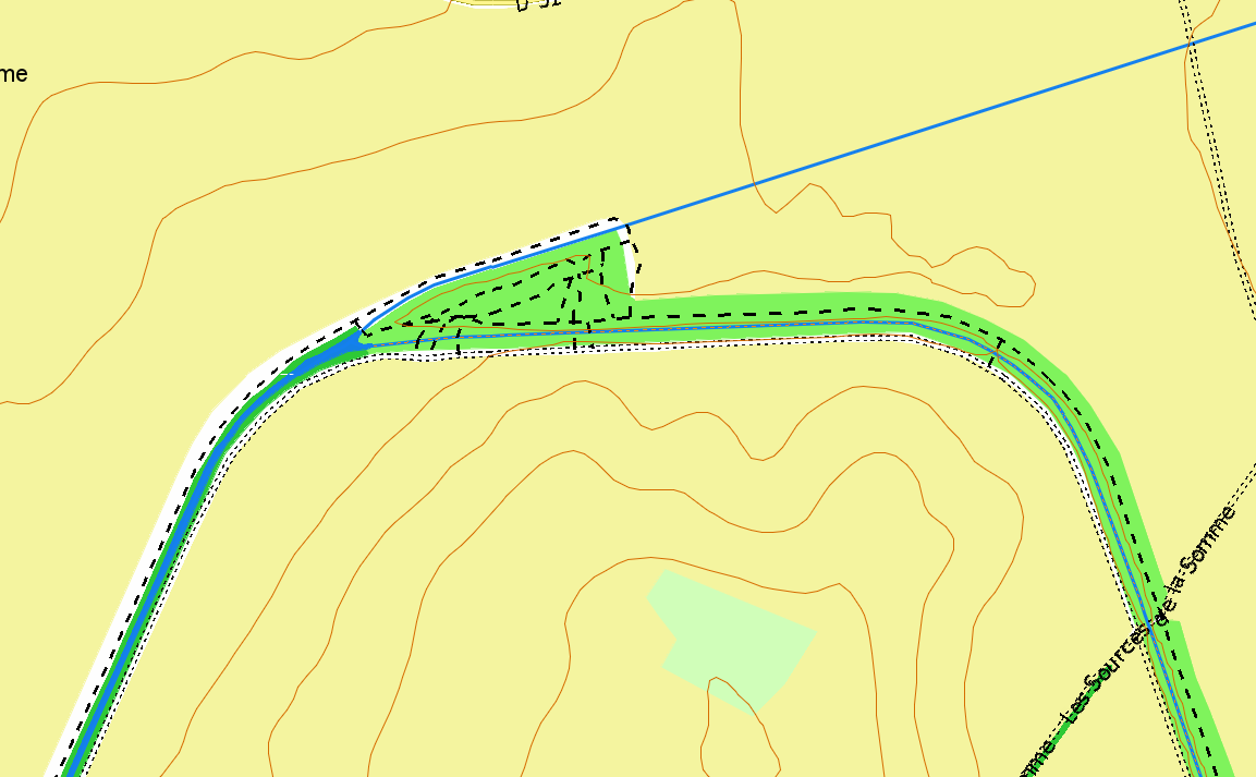
You can also modify the visual appearance—as I did in this example (using the IOF style)—which is equivalent to the TYP file options used when importing OpenMTB maps.
-
Another feature available to every user (as with Garmin) is the ability to import data and create custom maps.
I don't think hovering your mouse over the map while riding is particularly useful.
On the other hand, being well-guided along your route is, in my opinion, more important; the fewer questions you have to ask yourself about the route, the better. You enjoy the ride more, stay on schedule, and experience less stress. Guidance is essential.
When planning your route, you can add waypoints (without the quantity limits found on Garmin devices) and attach photos or maps to them to avoid getting lost. There is also no limit on the number of points in a route (unlike with Garmin), so you can create long, precise, continuous routes.
The main thing is not getting lost, minimizing time spent figuring out your location, having a screen that is easy to read in direct sunlight or under tree cover, and having a GPS with decent battery life—enough for at least a full day of hiking (something only the very latest Garmin models offer).
-
Hi Mark, some adaptation are possible but that is limited and they ceased the devolopment some years ago for window dressing and this online crap which is a source of frustration for those who hoped that the map development would be developed further. For instance the names of ways/trails can only be shown inside the way/trail which is not really helpful. Some users have created some custom OSM maps that are trying to make the best out of it inside the obvious limitations. Have a look here if you would like to try some samples:
-
Remember, adress search is still not possible on OSM maps (doesn't matter if created by Compe or users), which is disappointing too. But the rastermaps are nice and having a routable vectormap as overlay and unlimited maps, trails, waypoints open at the same time is keeping us still with the company.
-
For Charles:Okay, a vector map derived from OSM is provided, but how and how often can we update it? As for the additional openMTB trail data—it’s handy because the info isn't normally visible on the map, appearing only when you tap a point on the trail; still, if you happen to need to detour while out riding, knowing the trail's difficulty level would be useful. Meanwhile, regarding the latest Garmin models—specifically the H1 and the touchscreen eTrex, which interest me—they suffer from a lot of software issues...
For Uwe:Thanks for the link to the site. So, for example, do you import only the vector data (containing just trails or roads) into Land (and onto the TwoNav GPS unit) and then overlay it on, say, the OSM base map supplied with the device? -
To your question: Example GPS device
Basemap for me (walking, climbing) is a topo Rastermap (DTK25 or DTK10). Those are often some year old so it makes sense to overlay it with an actual OSM vector map. Overlayed vector maps are by default so created, that only polylines (streets, trails, rivers etc.) and pois are layed over an raster image but not polygones (ponds, houses, greenland, wood etc.) - this can be changed later via clay but that is another story. With this setting, routing is possible on a map that looks like an (updated) paper map, which is exactly what I need for my usage.
But since you are using Android, the devices look almost the same but have a less computing power.
Regarding actualization of OSM maps. It is a little like hope they are doing it soon! For instance, this is a list of all the OSM maps of the British Isles sold by Compe:
BritishIsles_OSM_12q3BritishIsles_OSM_14q1BritishIsles_OSM_15q2BritishIsles_OSM_21q2BritishIsles_OSM_26q3Since they are not charging us double for an OSM update, we really can't complain and they don't have a monetary motivation to update them more often.
Regarding creating an OSM map yourself: Actual Land versions are known to fail in creating usable vector maps out of OSM data. The last version which most of the creators are using is v8.96. Compe is trying to sell as the mpv format instead of the much compacter mpvf format, but this format can only be used for small maps. They just fu**ed up the mpvf format creation somewhere in the version 9 development and didn't care to repair this. I personally hope that Land v11 can create usable mpvf maps again, since Compe just recently brought an usable OSM update out but in the release section of V11 is no mentioning of changes regarding vector map creation.
-
Thanks Uwe.
So, not only in Land but also on the TwoNav device itself, you use a base map with the vector OSM map provided by Compe overlaid on top; however, I haven't figured out whether that vector OSM map supplied with the device can be updated for free or if there's a charge for it. On my Garmin, I used to update the openMTB vector map roughly every six months, even though they release updates—I believe—on a weekly or monthly basis. Ultimately, if the vector component of the OSM MTB maps (meaning just the trails, roads, and individual POIs) could simply have been exported in a format compatible with TwoNav devices—allowing it to be overlaid on a custom raster map—TwoNav sales would have increased significantly.
-
No, I mostly use those vectormaps I linked before and not the ones I bought from Compe (didn't cost much). That seems to be the same as with the Garmin devices - those openMTB maps which are provided for free by the community are more often updated. So missing updates are neither with Twonav nor with Garmin a company problem but a community problem. With the right tools and a Land version license lower than 9 you can do this yourself (it is not so difficult to reduce an OSM map to trails, roads, and individual POIs - but the detailed processing depends on what you hope to get [for instance mountain huts are often not defined as POIs but as multipolygones, which Land can't transform into POIs, so other way must be found]) but don't blame Compe for it because Garmin doesn't do it either. It is the missing community that is to blame for those updates you crave.
-
Hello
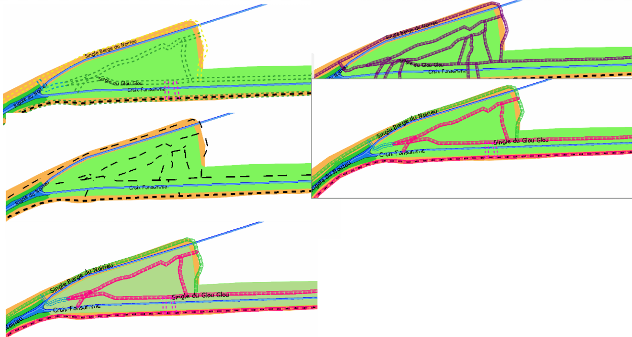
This vector map has been updated following the repositioning of trails based on LiDAR terrain data.
The visual appearance, colors, and rendering style vary depending on the GPS screen type (this example uses a PC, which has a high-resolution screen).
These examples serve two purposes: first, to show that updating vector maps (just like the previous raster maps) is no longer a drawback in 2026; and second, to demonstrate that the visual appearance of both raster and vector maps is customizable—much like Garmin’s *.typ files, TwoNav uses *.clay files.
There is no longer any real need to overlay a vector map onto a raster map; QGIS allows us to directly integrate specific data into the raster map's visual style (for example, trail colors indicating rideability). If a user wants to update their map, they simply need to import OSM highway data (via QuickOSM), replace the existing layer with the new one in QGIS, and then export the result in MBTiles format.
-
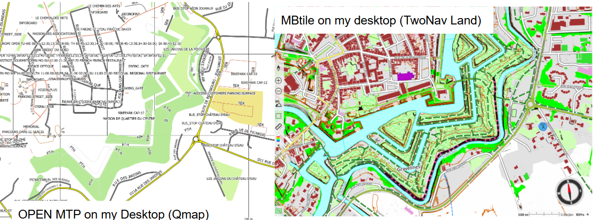
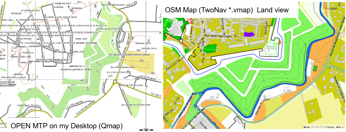
When I create a GPX track on my PC to follow later on my mountain bike (or on foot)—even though I have various maps in QMap (and some in BaseCamp too)—I mainly use OpenMTB maps; they offer extra information about the trails, and I’m also an OSM contributor (I’ve mapped several trails in my local area). So, if I were to get a TwoNav GPS and Land software, I’d still end up creating my tracks in QMap or BaseCamp... But there’s no point in chasing the impossible; OpenMTB isn't compatible with the TwoNav ecosystem at the moment. Thanks for the suggestions.
-
That's not entirely true. I would specify it as: OpenMTB isn't compatible with the TwoNav ecosystem at the moment as vectormap.
Trackcreation shouldn't be a problem in Land, a good rastermap and an actual vectormap as upper layer should give you suffizient data for track creation in Land. The question is rather, do you really need a subscription for your purpose.
Bitte melden Sie sich an, um einen Kommentar zu hinterlassen.
Kommentare
47 Kommentare